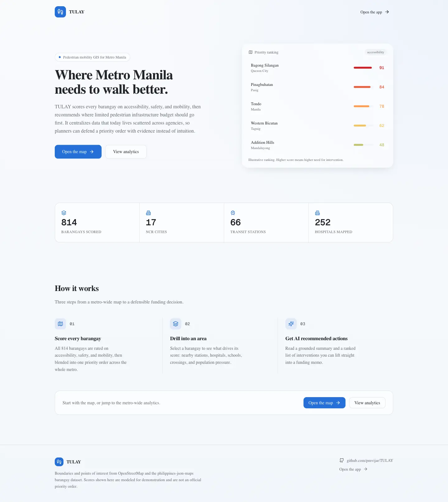
01Overview
A data-driven GIS tool that turns open data into a budgeting decision: which streets get pedestrian infrastructure first.
02What I built
-
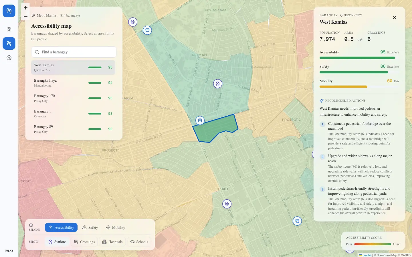
Glass GIS shell
Floating data panels over a full-bleed Leaflet map, with a drill-in barangay profile and toggleable transit, hospital and school overlays.
-
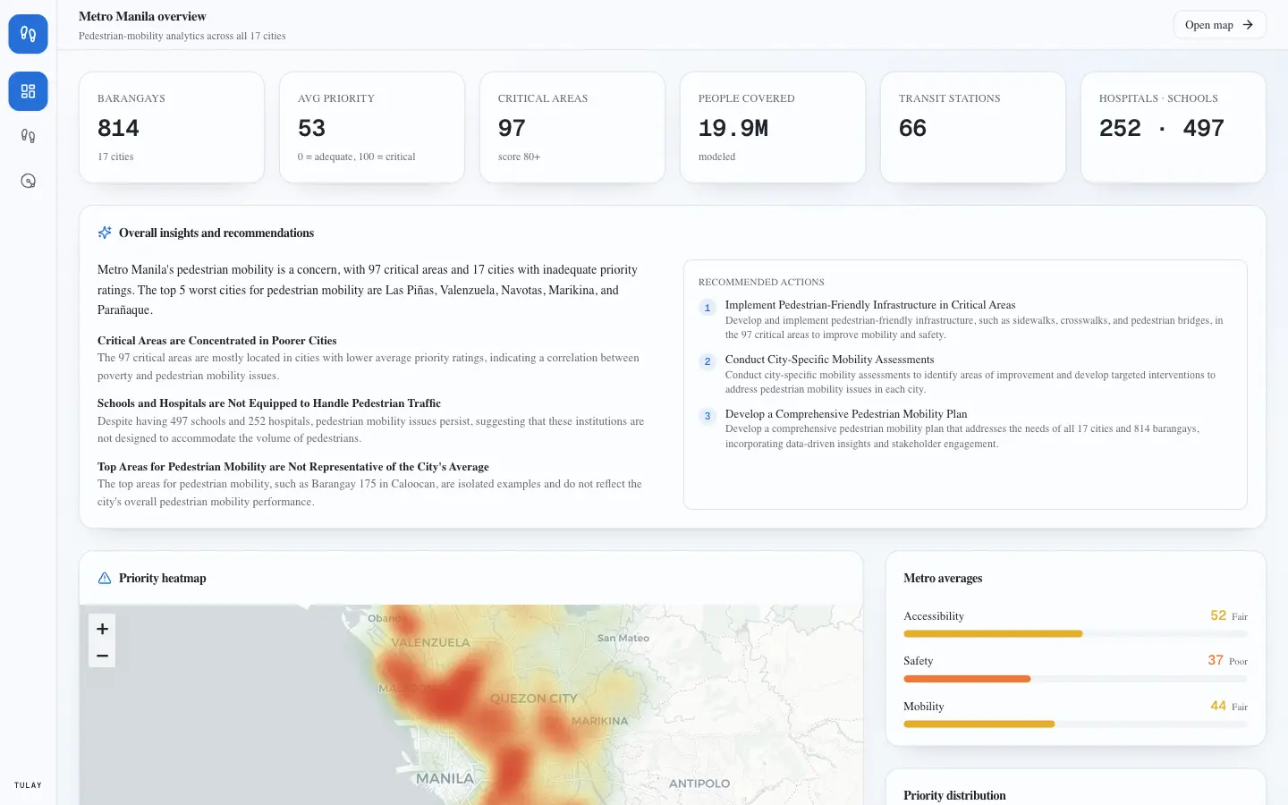
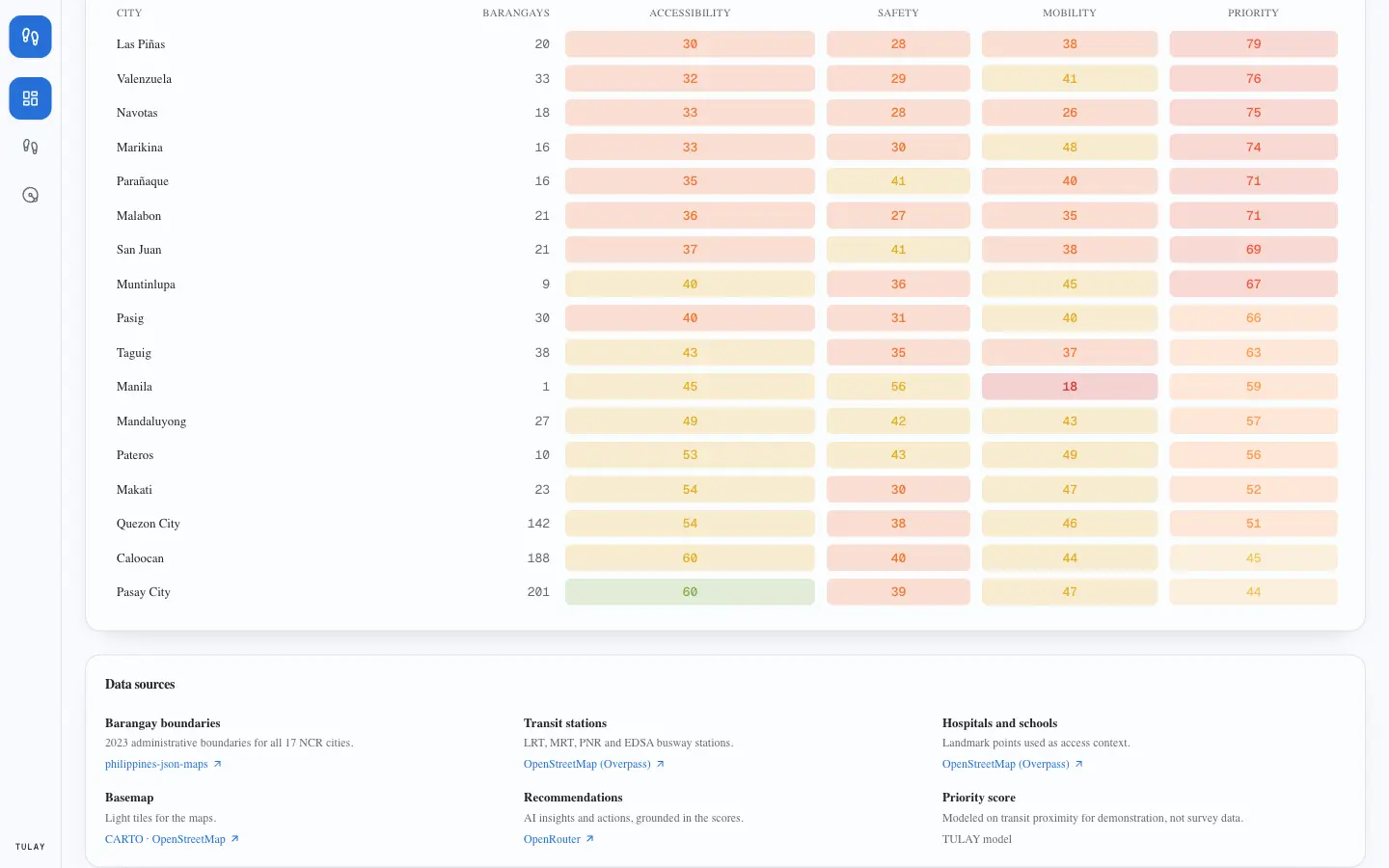
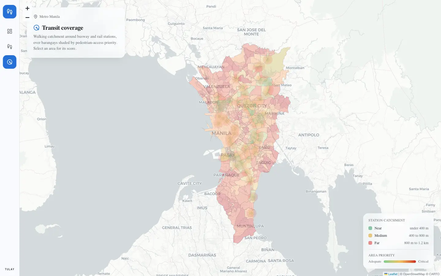
Scraped a whole metro
814 barangays across all 17 NCR cities, joined to OSM transit, hospitals and schools, scored on accessibility, safety and mobility.
-
AI that prioritises
Grounded LLM calls turn an area's weakest scores into ranked infrastructure actions, with deterministic offline fallbacks.
-
Shipped end to end
Provisioned and seeded an Atlas cluster, deployed to Vercel with server-side secrets, verified every route in a real browser.
03Selected screens
04Tech
Next.js 14React 18TailwindLeafletRechartsMongoDB AtlasOpenRouterVercel
Next project — Financial Compliance Platform
SiLab